Description
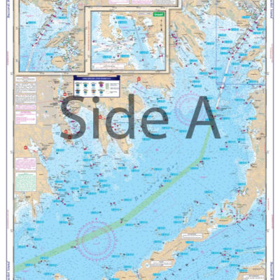
Newly compiled for 2014, with the best coverage of these most popular rivers. Side A has complete coverage from Sebasco on the New Meadows River, around Cape Small, and up to Bath. Side B gives you great detail of Bootbay up the Sheepscott to Wiscasset, as well as the Damariscotta River up to Little Point, just south of where the river passes under Route 1. With the help of local guides and tackle stores, we have pinpointed the most likely areas to hold Striped Bass, Mackeral, Atlantic Cod, Bluefish, and Flounder. These areas are designated on the charts with a symbol of the species caught in that area. We have also pre-plotted dozens of GPS Waypoints to make it easier for you to find these hotspots. You can sit at the dock and enter the coordinate into your GPS and you are on your way to some great fishing. No need to struggle to see the numbers as these waterproof, folded products come in the popular large print format. We have added boat ramps and marine facilities for your convenience. This chart is a great complement to all of the other Waterproof Charts of this area. NOAA Chart #13293. For the best detail of the Kennebec, Sheepscot, and Damariscota Rivers, you need this detailed fishing chart. Side A has complete coverage from Sebasco on the New Meadows River, around Cape Small, and up to Bath. Side B gives you great detail of Boothbay up the Sheepscot to Wiscasset Maine, as well as the Damariscotta River up to Little Point, just south of where the river passes under Route 1. With the help of local guides and tackle stores, we have pinpointed the most likely areas to hold Striped Bass, Mackeral, Atlantic Cod, Bluefish, and Flounder. These areas are designated on the fishing charts with a symbol of the species caught in that area. What other fishing charts offer this level of insider information!? We have also pre-plotted dozens of GPS Waypoints to make it easier for you to find these hotspots. You can sit at the dock and enter the coordinate into your GPS and you are on your way to some great fishing. No need to struggle to see the numbers as these waterproof, folded products come in the popular large print format. We have added boat ramps and marine facilities for your convenience. This chart is a great complement to all of the other Waterproof Charts of this area and looks amazing on your wall when framed. NOAA Chart #13293. Nautical Chart is 25″ X 38″. WGS84 – World Mercator Datum.


Reviews
There are no reviews yet.